Proposed Housing and Mixed-Use Site Allocations
Ended on the 28th August 2025
Barkston View responses
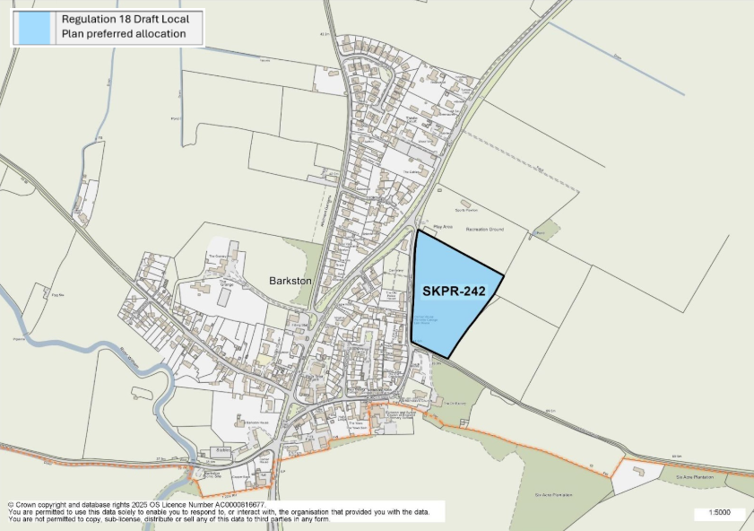
Figure 9: This map shows the village of Barkston and highlights one site allocation. SKPR-242 was identified as a preferred housing allocation in the Regulation 18 Draft Local Plan.
SKPR-242 Land East of Honington Road View responses
Indicative Unit Numbers: 54
Assumed Density: 25 dwellings per hectare to accommodate conservation area and adjacent listed buildings.
The following development principles accompany this allocation:
- Landscape screening and sensitive design to the northern boundary will be required to reduce the impact on views into the site from the recreational ground.
- The south west corner of the site shall not be developed but utilised for open space provision, landscaping and sustainable urban drainage (SUDS), as necessary. This is to ensure no negative impact to Minnetts Hill and protection of important views towards the Church of St Nicholas and its setting.
- Possible impact on the Conservation Area and adjacent listed buildings shall be considered to mitigate possible harm a low-density residential scheme should be proposed.
- Pedestrian links, such as footway and cycleway connections into the village from the site and towards the recreational ground should be incorporated into the development proposal.
- This site is within or includes a Green Infrastructure Area. Proposals on this site should incorporate the relevant principles for development within Green Infrastructure Areas set out in Policy EN3 Green Infrastructure.
For instructions on how to use the system and make comments, please see our help guide.