Proposed Housing and Mixed-Use Site Allocations
Ended on the 28th August 2025
Harlaxton View responses
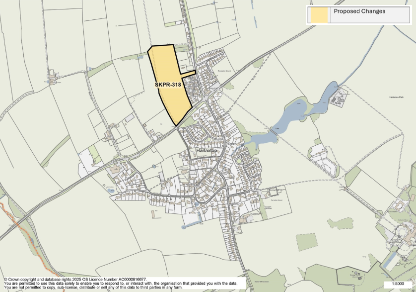
Figure 17: This map shows the village of Harlaxton and highlights one housing allocation. SKPR-318 is proposed as a new housing allocation.
SKPR-318 – The Land West of The Drift View responses
Indicative Unit Numbers: 112
Assumed Density: 30 Dwellings per hectare
The following development principles accompany this allocation:
- Landscape buffers/green infrastructure to be provided to the north and west of the site, and to the southern boundary to retain open nature of A607.
- Links to be provided to adjacent development.
- This site is within or includes an area of Biodiversity Opportunity. Proposals on this site should incorporate the relevant principles for development within Biodiversity Opportunity Areas set out in New Policy 4: Biodiversity Opportunity and Delivering Measurable Net Gains.
- Transport Assessment required.
- Site falls within the catchment risk zone of Allington Meadows SSSI. Sufficient evidence that the drainage will not cause significant impact to the designated site.
- Heritage Impact Assessment required. Material palette to reflect Conservation Area.
- Pedestrian footways and crossing points required in the vicinity of the site
Access via A607 and The Drift
For instructions on how to use the system and make comments, please see our help guide.