Proposed Housing and Mixed-Use Site Allocations
Ended on the 28th August 2025
Langtoft
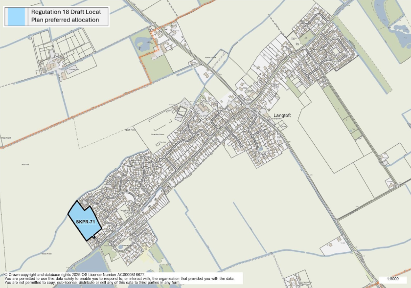
Figure 18: This map shows the village of Langtoft and highlights one housing allocation. SKPR-71 was identified as a preferred housing allocation in the Regulation 18 Draft Local Plan.
SKPR-71 – Land North of Dickens Close, Stowe Road View responses
Indicative Unit Numbers: 55
Assumed Density: 30 Dwellings per hectare
The following development principles accompany this allocation:
- A suitable and sensitive boundary treatment will be required on the western and northern edges of the site to screen views from the open countryside.
- Potential landscape impacts should be mitigated through high quality design and landscaping.
- This site is within or includes a Green Infrastructure Area. Proposals on this site should incorporate the relevant principles for development within Green Infrastructure Areas set out in Policy EN3 Green Infrastructure.
- Pre-commencement investigations should be carried out due to potential for archaeological remains on the site.
For instructions on how to use the system and make comments, please see our help guide.